Fall Frenzy: Providing Information for Ecosystem Research and Fishery Management
By Ivonne Ortiz and Thomas Van Pelt
While the fashion world has Vogue’s famous September Issue, the Alaskan fisheries management world has the less-famous but very consequential “Stock Assessment and Fishery Evaluation Report”, aka the SAFE Report, led by the Alaska Fisheries Science Center (AFSC). Every year, there is a flurry of activity from summer through fall, analyzing, compiling, and synthesizing information about Alaskan marine ecosystems and fish stocks. This burst of activity is directly tied to the annual management cycle for Alaskan federal fisheries, led by the North Pacific Fisheries Management Council, usually referred to by insiders as “the Council”. This regional council — one of eight around the USA — plans fishing seasons, establishes quotas, makes rulings on closed areas, and takes a host of other management measures within federal waters (3 to 200 miles offshore) year-round.
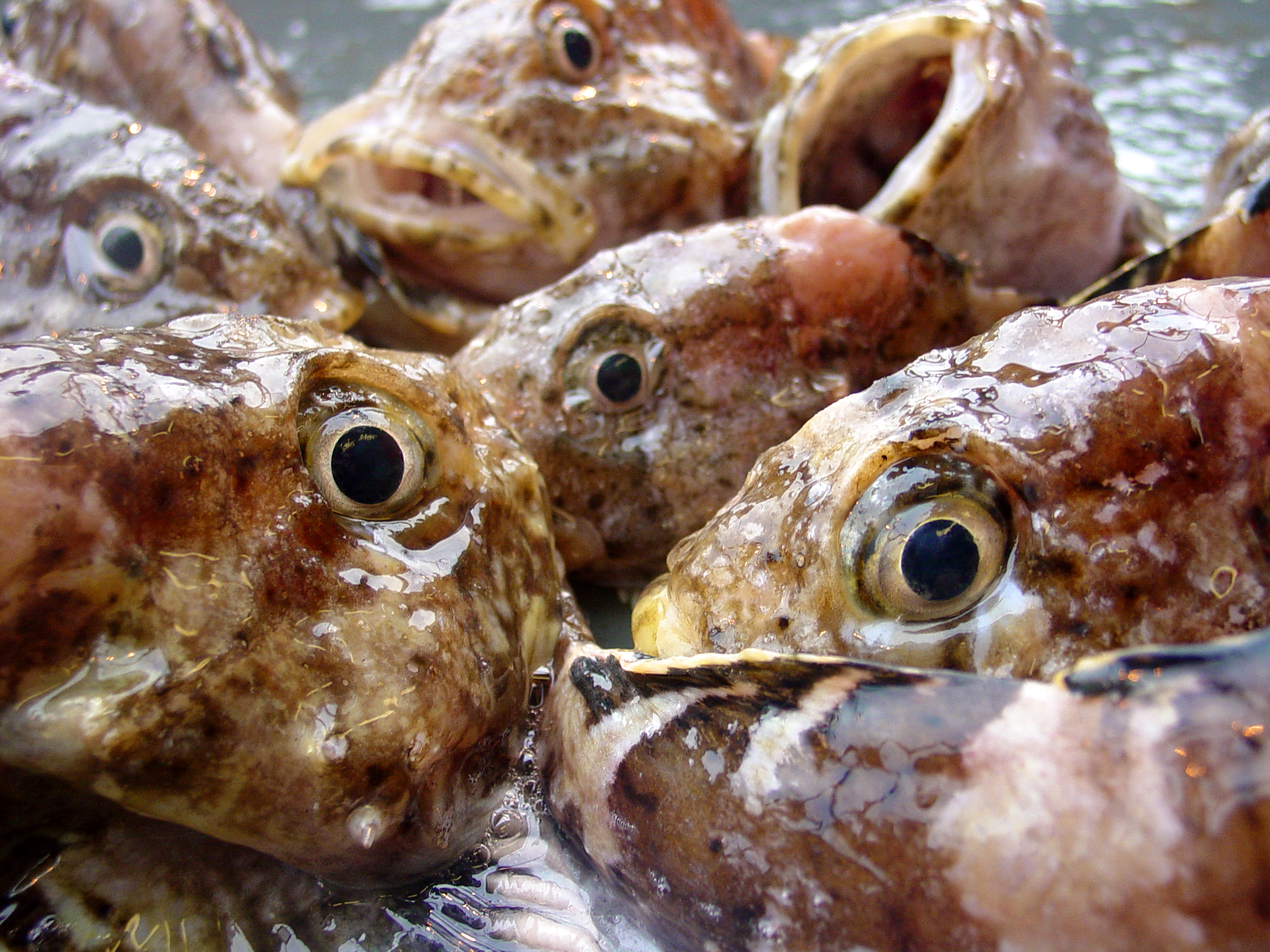
In fall, the Council discusses and sets the quotas for fishing in the following year. This is no mean feat! The Council sets catch limits for about 190 fish species in the Bering Sea, Aleutian Islands, and the Gulf of Alaska. And the physical and economic scale of those fisheries is huge. Alaskan fisheries comprise more than half of the U.S. domestic landings by volume — Dutch Harbor, in the Aleutian Islands, has been the leading port in terms of volume for over 20 years in a row. Chances are that if you, your family or friends throughout the country have had some fresh fillets, fish sticks, surimi, or fish and chips, you’ve enjoyed some fish from Alaska. In economic terms, Alaskan fisheries generate an annual wholesale value of more than $4 billion. A lot of those earnings go to Washington State and elsewhere in the U.S.; the true value and importance of Alaskan fisheries extends nationwide.
So given the giant scale of Alaskan fisheries, you can imagine that there is a lot of careful discussion and work required to set fair rules for sustainable harvests and to implement ecosystem-based fishery management, a holistic approach that recognizes all the interactions within an ecosystem rather than considering a single species or issue in isolation.
Behind-the-scenes look at the process of putting together the Ecosystem Status Reports
Before catch limits are set, an important first step is for the Council to be informed about current ecosystem status and trends. The core mechanism for this step are “Ecosystem Status Reports” (ESRs), which are included within the SAFE Report. ESRs provide context for catch determination of groundfish and crab, and are the result of a large collaboration across 28 institutions and over 130 individual contributors who prepare sections according to their expertise. Most information comes from indicators, which are quantitative measurements that serve as proxies for the conditions of the ecosystems. The information is curated by a lead editor for each of the ecosystems: Eastern Bering Sea, Aleutian Islands, and Gulf of Alaska.
Here we highlight some of the contributions to the ESRs by CICOES researchers, and give a behind-the-scenes look at the process of putting together the Ecosystem Status Reports. Ivonne Ortiz edits the report for the Aleutian Islands along with Stephani Zador (AFSC, NOAA). Elizabeth Siddon and Bridget Ferris (also from AFSC, NOAA) edit the reports for the eastern Bering Sea and Gulf of Alaska, respectively.
The main activity starts in early summer amid the numerous summer surveys for fish, seabirds, and marine mammals. Requests for contributions go out to experts across Alaska and beyond: “Will you be able to provide …?”. Information must be for the current year, so the most readily available information is based on spring surveys and satellite data. Those trickle in from mid-August all the way through mid-September, just in time to give a climate and oceanography preview to the Council in early October.
The preview starts with an overview of the North Pacific climate, provided by Washington State Climatologist Nick Bond. This year Nick highlighted what entering a third La Niña year may mean for each region, explained some aspects of cooling in the Eastern Bering Sea and Gulf of Alaska and a continued warm phase for the Aleutian Islands. This intro is followed with other information on the environment, like winds, temperature, sea ice, transport, and ocean acidification.
Kelly Kearney, who ordinarily spends her days modeling the biogeochemistry of the eastern Bering Sea, provides information on the extent of the annual “cold pool”, based on a regional ocean modeling system for the Bering Sea. The cold pool is the region of the Bering Sea shelf where bottom water is < 2°C throughout the summer. It is a very meaningful oceanographic feature, forming a boundary between Arctic and subarctic aquatic animal communities and influencing the distribution of many commercially important fish, and thus the distribution of the fishing fleet. In 2020, Kelly’s model-based contribution was the only information available on bottom temperature, as there was no traditional bottom trawl survey that year due to COVID-19.
Air temperature is also included for the eastern Bering Sea, thanks to Muyin Wang, who provides information on air temperature at St. Paul Island. Wei Cheng continues the section on eddy kinetic energy (a section started by recently retired PMEL oceanographer Carol Ladd) which provides key information about nutrient and heat transport in the Aleutians and Gulf of Alaska. Darren Pilcher’s contribution on ocean acidification has gained relevance in recent years, particularly with regard to crab stocks in the eastern Bering Sea.
Biological information, whether from satellite data or summer surveys, is left for the full report in November. Indicators from satellite data arrive first. Jens Nielsen and Noel Pelland each lead analyses of remotely sensed (satellite) chlorophyll, used as a proxy for phytoplankton biomass. At the base of the food web, phytoplankton support a large portion of marine food webs. And in case you are wondering, the uneaten portion of phytoplankton sinks and supports the benthos — those organisms living on or near the bottom of the sea, or within the sediments. Noel is a physical oceanographer, but developed the phytoplankton indicator for the Aleutian Islands upon request, in collaboration with other researchers.
Alaska fisheries generate an annual wholesale value of more than $4 billion
Jens leads an assessment of coccolithophores, which are single-cell marine algae with an outside boundary of overlapping limestone plates/shields, called coccoliths. Smaller than diatoms, coccolithophores may be a less desirable food source for microzooplankton in the eastern Bering Sea. Depending on its magnitude, a coccolithophore bloom can reduce the light transmitted through water and make it difficult for visual predators to find prey. These blooms turn the ocean milky white, which can be seen from space depending on their scale, and have been implicated in seabird dieoffs.
By now summer survey data start coming in! Freshly collected and analyzed, these data are often prioritized for the SAFE report but provided after the information for the individual stock assessments. Survey based information can arrive as late as October, just before edits and drafts are finished to be sent for review in early November. Andy Whitehouse specializes in food-webs and contributes several community indicators based on groundfish. These include a stability index, and biomass of pelagic foragers and apex predators. The report also includes one-time projects that are noteworthy, or surveys that are regular but not done at fixed intervals. Examples from last year’s report include marine mammal distribution in the Gulf of Alaska, featuring work by Alex Zerbini, and Cynthia Christman’s collaboration on aerial surveys to determine the abundance of harbor seals in the Aleutian Islands. There can be over 60 indicators included in the report.
During October and November, each lead editor discusses the information with the contributors, evaluates the information, and after some sleep-and-food-deprived days, wraps up an assessment and draft of the ecosystem status report. The draft goes through internal review, and then is made available and presented to the Groundfish Plan Team, a group of scientists who review all stock assessments and prepare harvest recommendations. The Plan Team has a broad membership, including Council staff working with scientists from the regional office of the National Marine Fisheries Service (NMFS), NMFS’ Alaska Fishery Science Center, the Alaska Department of Fish and Game, the Washington Department of Fisheries, the International Pacific Halibut Commission, the University of Alaska, the University of Washington, and other institutions and universities.
A special kind of camaraderie develops from the brief but intense period of late nights and working weekends prior to the Plan Team meeting… a Sunday morning call to discuss some ideas, late afternoon chats about coding (the report is written in LaTex), coordinating answers to comments and recommendations from last year. There is a collective sigh of relief by everyone involved between the end of the Groundfish Plan Team meeting in mid-November and the Council meeting in early December. But we are not done yet!
The time between the Groundfish Plan Team and the Council meetings — when final decisions are made — is when the “inBriefs” are put together. These 4-page graphical summaries provide a public-friendly version of the assessment with highlights specific to each ecosystem.
Final drafts of the Ecosystem Status Reports along with the rest of the SAFE Report and the inBriefs are uploaded to the Council website and are made publicly available. Then our group of lead editors head up to Anchorage to present to the Council meeting, three times: first to the Statistical and Scientific Committee, then to the Advisory Panel (fishing industry, fishermen, consumers, observers, and NGOs) and — finally! — to the Council: 15 members who are a mix of fishery representatives, ADF&G, NOAA, Coast Guard, NGOs, WA and AK state representatives. And yes, as editors we get different questions each time depending on that year’s conditions, status of the fisheries, and each panels’ interests. The fall frenzy comes to its end during this final stage, when quotas are discussed and finalized. This last public and well attended meeting wraps up the ESR process, and is a buzzing get-together from morning to night.